Divis to Cavehill, Belfast – highwaymen, a buried treasure and the last wolf in Ireland

Divis and Black Mountain

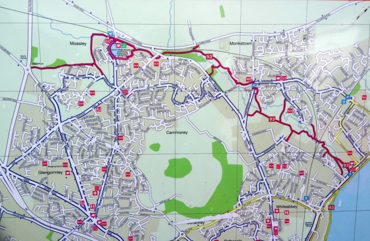
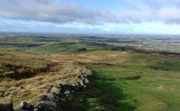
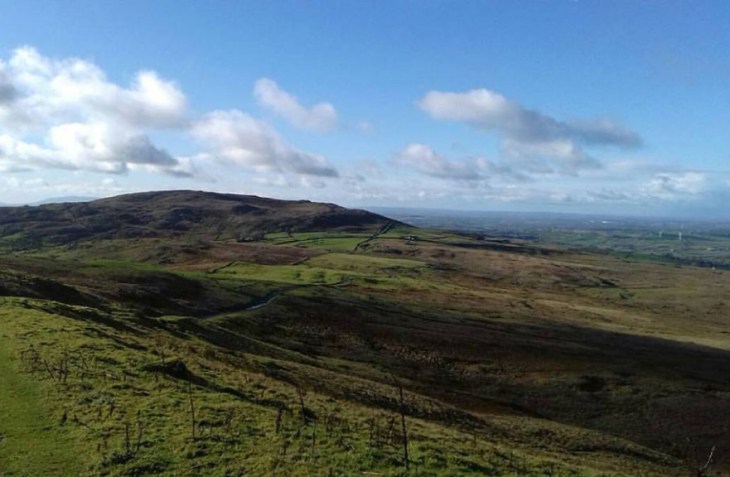
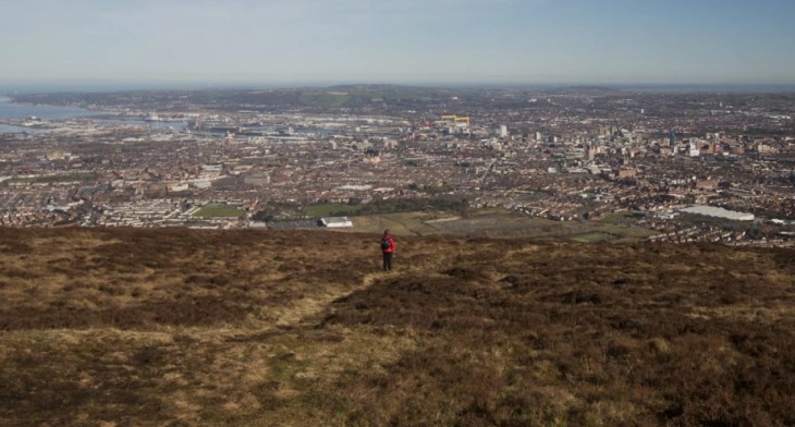
This is a walk not only dripping with history: a highway man’s buried treasure, the last wolf in Ireland and a noble hunting ground but also great views of the city of Belfast and a wealth of nature including red grouse, skylarks and peregrine falcons.  For a map and detailed statistics go to https://www.wikiloc.com/hiking-trails/divis-to-cavehill-belfast-23845640


Divis and Black Mountain 1

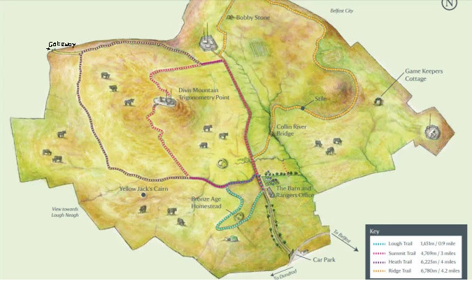
We started the walk at the National Trust car park on Divis Road, off the Upper Springfield Road.  This is a linear walk so it is worth arranging return transport.

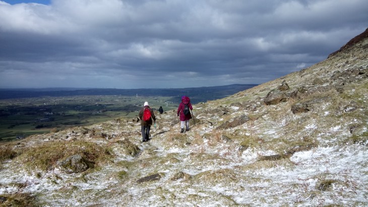
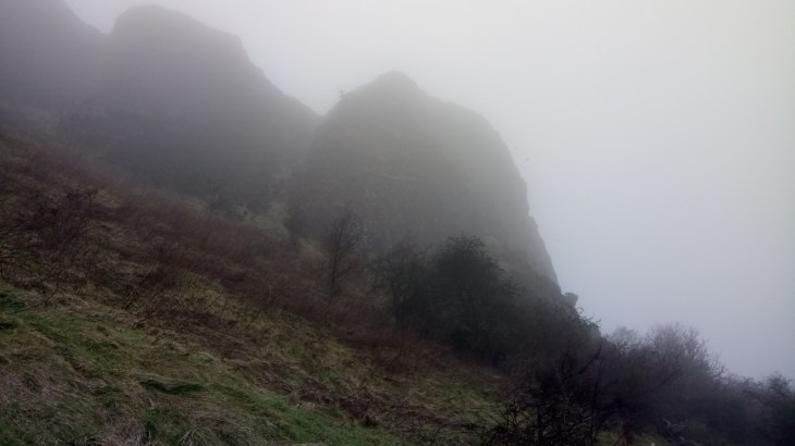
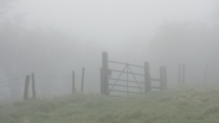
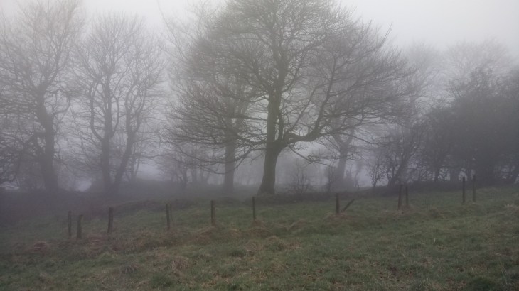
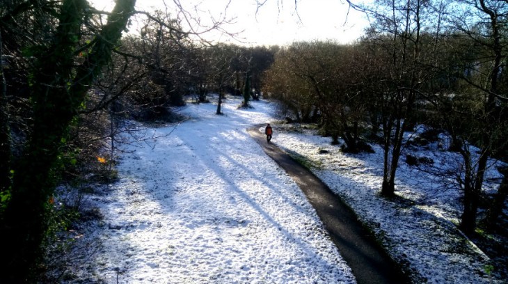
We followed the path to the café and then took the Lough Trail.  When we reached the Heath Trail we turned left uphill to reach the Summit Trail which brought us up and over Divis Mountain.  On the other side of Divis, we turned left on the Heath Trail again and continued straight ahead to reach a gateway as marked on the map above.

D&M 2

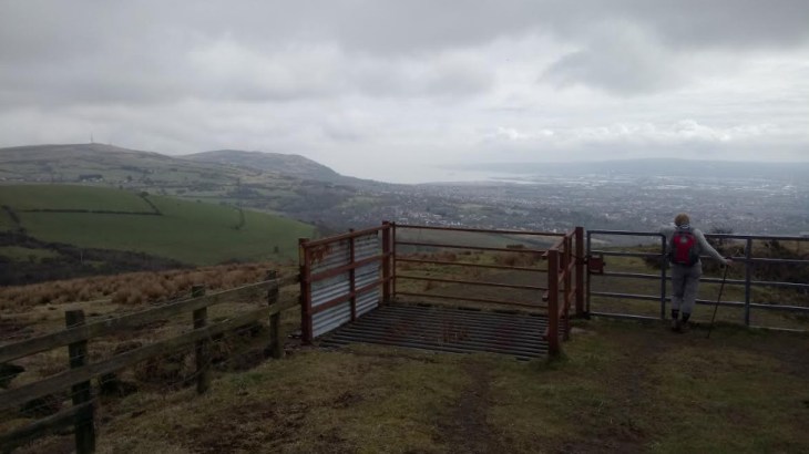
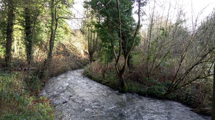
Gateway at the end of the Heath Trail. Go left here across rough open ground to reach a stile beside a stream.

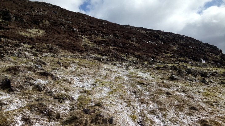
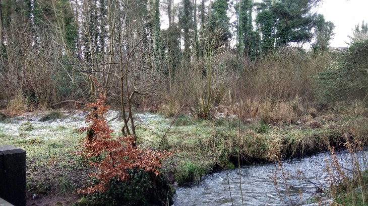
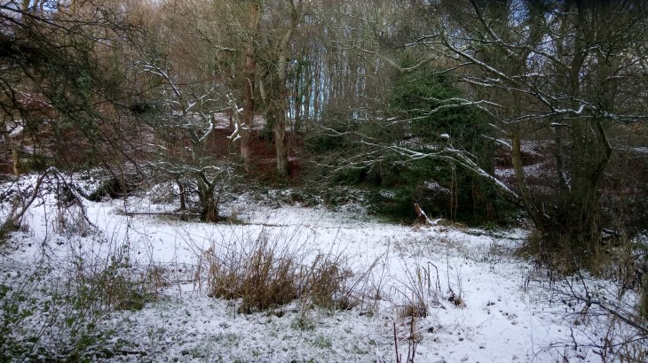
From here we kept left and crossed rough open scrubland, dropping down to cross a stile beside a stream and then climbing up to the ridge to find an old road going left, right.

D&M3

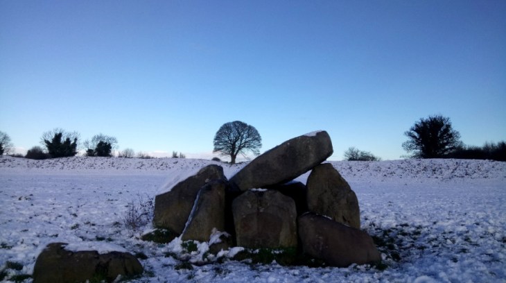
To the left, there is a red brick building and the remains of a village which was once occupied by a family of highwaymen and in particular, the highwayman of the hills  Neece O’Haughian. His farming family had been dispossessed of their land during the Plantation of Ulster. O’Haughian took revenge by becoming a highwayman. He robbed the rich and offered to help the poor farmers. He hid out in the Belfast Hills until his capture in 1720.  The outlaw of the hills was hanged at Gallows Green, Carrickfergus.  His treasure is said to be still buried in the Belfast Hills, five jumps to the east of a spot where you can see five castles, five loughs and five counties.  It’s worth having a look and the old village is a great spot for lunch.

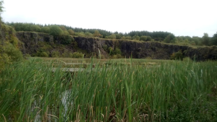
From the village, we continued along the old road towards Cavehill, passing Wolf Hill and  Wolf Hill Quarry and finally, coming to a gate giving access to the Upper Ligoniel Road.  The name Wolf Hill originated as the last wolf in Ireland is said to have been shot there by a farmer in 1692.

At this point on the Upper Ligoniel Road, due to an access dispute, it is necessary to make a short detour. We went right, down the hill, took the first on the left and then left again on to the Ballyutoag Road and veered slightly right on to the Flush Road.  While making this detour, you will notice one of the low points of an otherwise beautiful walk.  The amount of litter thrown out by  passing traffic is appalling.

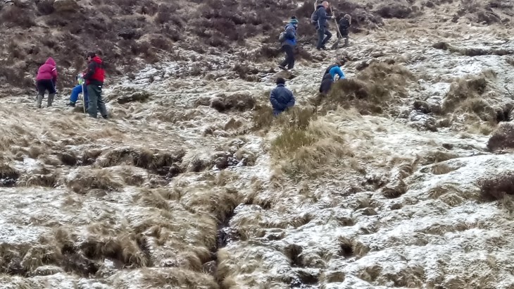
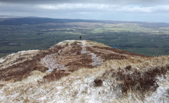
Once past the houses on the Flush Road, we crossed a stile on the right and by keeping to the left of the fence we crossed a series of small crude stiles which brought us up to the summit of Squires Hill.  This was once part of one of the biggest estates in County Antrim and the hunting ground of the Donegal’s and the rich linen barons.

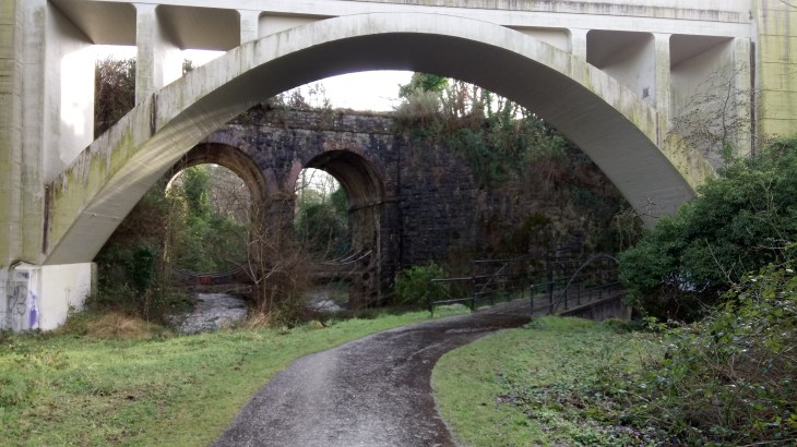
We dropped down the other side passing an old quarry to reach the Upper Hightown  Road.  We turned left to reach the Cavehill Country Park, within a few hundred metres.

D&C 5

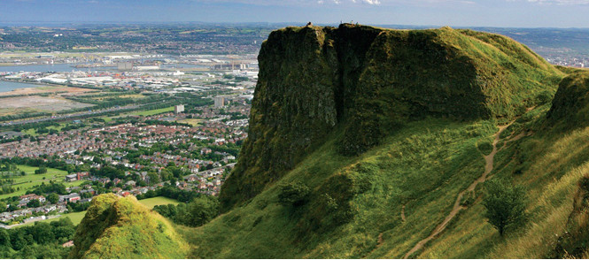
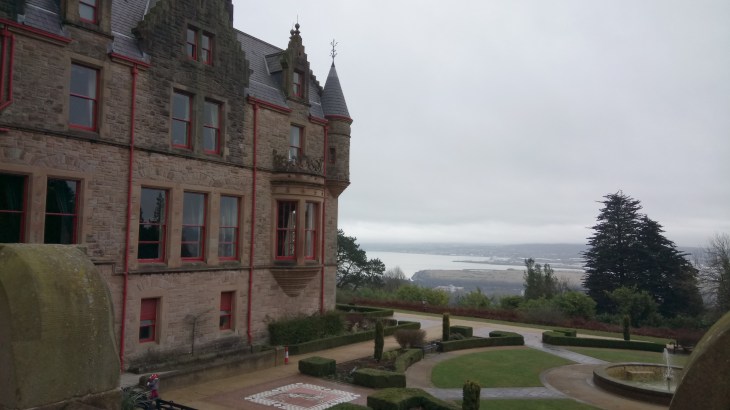
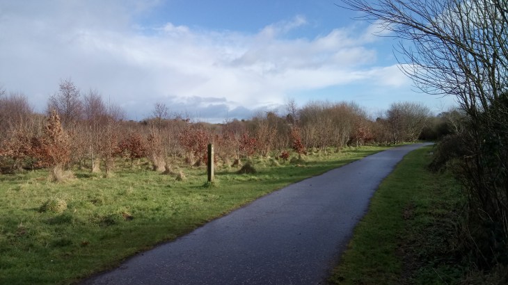
The signage in the park is excellent and took us easily to McArt’s Fort   https://en.wikipedia.org/wiki/Cavehill and finally to Belfast Castle.

D&M 6


Climbing Slemish on Saint Patrick’s Day

Slemish.jpg

Climbing Slemish is one of the many pleasures of Saint Patrick’s Day.   The ascent can be slippery in places which gives it a frisson of excitement and adventure verging on danger.  Nevertheless, everyone from sturdy well-advanced toddlers to grannies and their dogs swarms up in large numbers to enjoy the glorious views,  traditional music and a picnic on top.  This year,2018, the threat of the imminent arrival of the ‘beast from the east, minor’ impacted substantially on the numbers. However, it was still a splendid experience.

Slemish 1.jpg

Slemish Mountain (Sliabh Mis) is about 10 km (6 miles) from Ballymena and is the legendary first-known Irish home of Saint Patrick. The mountain rises about 1,500 feet (460 metres) above the surrounding plain, and it is the central core of an extinct volcano, commonly known as a volcanic plug. According to legend, following Patrick’s capture and being brought as a slave to Ireland, the young man worked as a shepherd at Slemish Mountain for about six years, from ages 16 through 22, for a man named Milchu (or Miluic).

During this time Patrick turned to frequent prayer in his loneliness. In a vision he was encouraged to escape and return home. He did, became a Christian priest and returned to Ireland, allegedly to convert his old master. The legend tells that his true conversion occurred when he was on Slemish out in all weathers, communing with nature and praying continuously. As Patrick was not the first Christian bishop to visit Ireland, his ministry was confined to the North. Here he established churches and an episcopal system. One such church is thought to have been founded at the nearby site of Skerry Churchyard.

Slemish4

Park in Bucna at the Presbyterian Church from where there is a regular shuttle bus service to the starting point. The 1.5-kilometre round walk to the summit and back takes approximately one hour in good weather. Excellent views can be had of the Antrim and Scottish coasts to the East. Ballymena town, Lough Neagh and the Sperrin Mountains are all normally visible to the West whilst the Bann Valley and the higher summits of the Antrim Hills can be seen to the North.  The 180-metre climb is not easy but the views from the summit make it all worthwhile.

Slemish3

A Misty Day on Cavehill

A circuit of Cavehill is another great Belfast walking option.   It is easily accessible from the city centre by public transport.  For a map and statistics go to https://www.wikiloc.com/hiking-trails/cavehill-circuit-22734223

CaveE

Cave Hill is a basaltic hill 370 metres high and forms part of the southeastern border of the Antrim Plateau. It is distinguished by its famous ‘Napoleon’s Nose’, a basaltic outcrop which resembles the profile of the famous emperor Napoleon.  Historically known as Ben Madigan, which is derived from the Irish Beann Mhadagáin, meaning “Madagán’s peak”—so named after a king of Ulster called Madagán who died in 856AD.

Cave Hill is also thought to be the inspiration for Jonathan Swift’s Gulliver’s Travels. Swift imagined that the Cave Hill resembled the shape of a sleeping giant safeguarding the city.

CaveD


CaveA

As you can see from the images this was more of a Bram Stoker/Dracula rather than Jonathan Swift class of a day.  However, walking in the mist has it’s own mindful pleasures.  You are certainly not distracted by those gaudy but gorgeous views of the city.

Begin at the interpretative panel in the car park just before the entrance to Belfast Castle and find the route marked Cavehill circuit.  Follow this path through the woodland,  through the trees, climbing up to a plateau.

Continuing on, take the next path on your left. This skirts around the Devil’s Punchbowl passes below the largest cave before veering to the right. At the time of writing, there is no access to the cave as there has been a recent landslide. Follow this path as it climbs steadily up the hill.

CaveC

Continue climbing up the steps to a cattle grid and fence, at the top veer to the left and follow the grass path to the top of the hill and McArt’s Fort.

This fort, on the summit of the hill, is an example of an old rath or ring fort, a circular enclosure surrounded by an earthen wall: used as a dwelling and stronghold in former times. It is protected on one side by a precipice and on the others by a single ditch. It is believed that the fort’s inhabitants used the caves to store food for the winter and may have served as a refuge during times of attack.  This was also a meeting place of the United Irish Men in the eighteenth century.  Lots to think about as you swim ever onwards through the mist.

CaveB

Continue downhill taking the next lane on your left. This leads down past the top of Carr’s Glen and carries on for some distance before reaching the Upper Cavehill Road. Go down the footpath a short way and take the path to the left. Climb over the ridge and descend into Belfast Castle Estate. Return to the starting point by means of the footpath up the main driveway.


Newtownabbey Way

The Newtownabbey Way is another one of those hidden gems of Belfast, easily accessible by all forms of transport and perfect for a short walk, especially on a winters day.  For a detailed map and statistics go to https://www.wikiloc.com/hiking-trails/newtownabbey-way-22586800.

NTA 2

The Three Mile Water near Mossley Mill

The walk runs from Corrs Corner roundabout in Glengormley to Glen Park near the Lough Shore.  It is equally delightful either way and on this occasion, we started at the small car park at Glen Park on the Glenville Road just off the Shore Road and near the Lough shore.  It is almost traffic free save the occasional road crossing,  is very well signposted and has stretches of great natural beauty as well as impressive reminders of our industrial past.

Nta 7

Bleach Green Railway Viaduct

We followed the path until we reached the impressive Bleach Green Railway Viaduct. The Viaduct was completed in 1933 to allow trains to run between Belfast York Road Station and Ballymena without having to reverse at Greenisland. We passed under the Viaduct to reach the parkland and Monkstown Wood, managed by the Woodland Trust. Here you will find a mixture of habitats, including grassland, mature woodland and recently planted woodland. There are at least 15 species of young native trees, over 8,000 in total including oak, cherry, hazel, ash and rowan.

NTA 3

Monkstown Wood

We continued through Monkstown Village, the way is well signposted, to reach the Three Mile Water Conservation Park.

Nta 5

The Three Mile Water

There are many intriguing little sidetracks begging to be explored but on this occasion, we followed the main path as far as the Mossley Mill Civic Centre and returned along the same route.

Nta 4

Mossley Mill Civic Centre

The Civic Centre is a former flax mill and was saved from demolition by Newtownabbey Borough Council in 1996. The restoration and the coffee are second to none and are both well worth a visit.

NTA 1

The Newtownabbey Way


Shaw’s Bridge to the Giant’s Ring Circuit

This is not only a beautiful, Belfast walk within easy access of the city centre but it also circuits one of the finest Neolithic earthwork henges in the country called, of course, the Giant’s Ring. To add to that, the heavy snow today made it nothing short of spectacular. For a map and statistics go to https://www.wikiloc.com/wikiloc/view.do?id=21481908

Giant's 4

Start at the car park at Shaw’s Bridge ( built 1709), cross the bridge and zigzag down to the river-side track, turning left away from the city.  Follow the track through beautiful open scenery to reach the Minnowburn. Cross the tiny bridge and follow the path going immediately left.  As it starts to ascend you will see the first sign for the Giant’s Ring and it is very well signposted from here.

Giant's 2

The Giant’s Ring would be impressive anywhere, but finding it without even leaving Belfast is remarkable. It is an enormous earthwork henge, roughly 180m across, with a stone passage tomb at its centre. The whole construction is thought to be more than 4,000 years old and has had some sort of public use throughout its history.

Giant's 3

Cross this remarkable site or walk half circle along the embankment to reach a stile and track which will lead you down to Edenderry village.  Walk through the village and pass through a gateway giving access to a path which will take you down to a bridge and the river towpath.  Keep right on the righthand bank and this will take you back to the Minnowburn from where you can retrace your steps to Shaw’s Bridge.

Giant's 1

Cutter’s Wharf to Kelly’s Cellars

This is a wonderful 4 kilometres Belfast afternoon winter’s walk along the beautiful River Lagan from Cutter’s Wharf to the city centre and the promise of music, craic and much more in the oldest bar in Belfast, Kelly’s Cellars.  For a map and statistics go to https://www.wikiloc.com/wikiloc/view.do?id=21357903

Kelly's 1

Start at the car park at Cutter’s Wharf, walk along Lockview Road to the roundabout at Stranmillis College and then follow the Stranmillis Embankment to where it intersects with the Ormeau Road.

Stranmllis1

Crossover and follow the Ormeau Embankment as far as East Bridge Street.  Cross again and follow Laganbank Road passing the Waterfront Hall to reach Upper Ann Street.  Walk down Ann Street, go right into Cornmarket, turn left into Castle Place and Bank Street and Kelly’s Cellars are directly in front of you between the Bank Buildings and Tesco Metro.

Kellys 2

Kelly’s Cellars is Belfast’s oldest traditional Irish pub, often described as “a hidden gem that oozes old traditional values”. It’s famous for the best pint of Guinness in Belfast.

Built in 1720, it is situated in the heart of the city. Kelly’s Cellars has changed very little in 200 years and still has most of its original features.

The whitewashed walls and uneven concrete floor are in keeping with a traditional Irish bar. There is nothing plastic about this place – it is the genuine article. Unlike modern places, the bar is what you would imagine a few hundred years ago – low arches and an original open fire make Kelly’s Cellars feel like home from home and people singing a song or two is a familiar part of a vibrant pub.

Kelly’s has rich musical heritage and Irish musicians from all over Ireland and beyond often call in for a few tunes in a relaxed atmosphere.

Kelly’s is also known for its history – the United Irishmen used Kelly’s cellars as a meeting place and plotted the 1798 rebellion against English rule, which is still prevalent in today’s political climate. Henry Joy McCracken, one of the leaders, was eventually caught and executed 300 yards from the bar. He is buried in a local cemetery, ten minutes walk from the city centre.

The Irish language is spoken by the owner and most members of staff and Irish speakers flock to Kelly’s and are proud to speak their native tongue and hear it spoken. The Irish language is an important part of our rich culture and has taken pride of place in Kelly’s Cellars!

This is a great spot to end a lovely Belfast winter’s walk!

Slieve Croob from Finnis, a Haunted Pub and the Twelve Cairns

This is a circular, moderate 10 kilometres walk which starts at, what is reputed to be, the smallest, oldest and most haunted pub in Ireland, James King’s Bar, established 1830,  and rises to the ‘Twelve Cairns’ on Slieve Croob, thought to be a Bronze Age burial site.  For a map and statistics go to https://www.wikiloc.com/wikiloc/view.do?id=18725608

Finnis2

Park in the village of Finnis, locally known as Massford, which lies on the southern slopes of  Slieve Croob (from Irish Sliabh Crúibe, meaning ‘mountain of the hoof’).  There is usually a space near James King’s Bar if you dare!  In the early years of the 20th century, a malevolent spirit is said to have haunted the bar and the area around the Dree Hill Road bridge just opposite, in the centre of Finnis, which spans the upper reaches of the River Lagan. By this bridge stood a large and beautiful sycamore tree. Knowing the terror the bridge set in the hearts of his parishioners, the village priest set out to exorcise the spirit and managed to capture it in a bottle. He then placed the bottle containing the spirits inside the sycamore tree.

There it remained and the bridge became free of the hauntings. From that day on and, with knowledge of the tree’s part in the exorcism, nobody in Finnis would touch the tree nor would they allow anyone else to touch it either.

Subsequently, the tree died and looked as though it has been killed by a lightning strike. Some years back, when either power lines or telephone lines were being run through the village, the tree stood in the way of progress and the priest had to be called to stop the workers from cutting it down. As a result, they had to run the cables through the tree’s upper branches.  The tree was finally felled, only recently, by the hand of mother nature in a violent winter storm but the bottle has never been discovered.

Finnis3

The ‘Haunted Tree’ opposite James King’s Bar in the Village of Finnis, power lines had to be re-routed.

Cross the previously haunted bridge, avoiding contact with any unattended bottles and follow the Dree Hill Road for a short way before turning left at Drin Road.  After approximately 2 kilometres watch out for a sign on the right for Passing Loaning.  Follow this lane to reach a gate and a stile.  Cross the stile and ascend the grassy slope following a rough track and a series of white posts.  This part of the mountain is known as Monahoora, not only are the views stunning but also this is a great place to listen out for the song of the Skylark or spot a buzzard.

Finnis4

The View from Monahoora

The waymarkers will take you to a tarmac road, turn left and follow it to the top of Slieve Croob.  There is an array of unsightly communication masts but there are the remains of a massive summit cairn. On this platform, several smaller cairns were raised, of various heights and dimensions, hence the name the Twelve Cairns.  Knowledge of this strange ancient structure has been lost in the mists of the past but the views remain magnificent.

Finnis5

Return to the tarmac road and follow it downhill.  This will bring you to a gate and a car park on the Dree Hill Road from where you can view the source of the river Lagan.  Turn right on leaving the car park and the road will bring you back to Finnis.

Cutter’s Wharf-Titanic Quarter-St. George’s Market

This is a great Sunday afternoon’s, Belfast walk.  You will enjoy the sporting activities on the river, the buzz of tourist life in the Titanic Quarter and finally, the lovely chaos that is St. George’s market.  It is just over 12 kilometres in length but easy.  For a map and more statistics go to https://www.wikiloc.com/wikiloc/view.do?id=20149819

Stranmllis1

Start at the car park at Cutter’s Wharf, walk along Lockview Road to the roundabout at Stranmillis College and then follow the Stranmillis Embankment to where it intersects with the Ormeau Road.  Crossover and follow the Ormeau Embankment as far as East Bridge Street.  Cross again and follow Laganbank Road passing the Waterfront Hall to reach the “Big Fish” or “The Salmon of Knowledge”.

Stranmillis3

Go right and cross the river here on the footbridge and this will take you into the Titanic Quarter.  Continue along the water’s edge passing the Odessey Pavillion and the SS Nomadic to reach the Titanic Building and the Drawing Offices nearby.

Stranmillis4

The Titanic Quarter is tourist central however, there is an interesting amalgamation of the story of the industrial development of the city of Belfast (a well-sanitized version) and the Titanic of  Leonardo DiCaprio and Kate Winslet.  Having soaked it as much of this rich history as you dare, retrace your steps across the footbridge, turn left at the “Salmon of Knowledge” and continue along Victoria Street to St. Georges Market.

2017-10-08 12.48.41

2017-10-08 13.05.39

St George’s Market on a Sunday afternoon is a treasure trove of experiences, so dive in, the water is lovely. Re-emerge at the Cromac Street end, thoroughly drenched in  Belfast razzmatazz and walk along Cromac Street to the Gas Works Business Park. Follow the walkway past the wonderful Radisson Hotel where you will find an underpass which will take you back to the Ormeau Embankment and, hence, back to Cutter’s Wharf.

Video of St. George’s


Colin Glen Forest Park and the Rumble Hole

Colin Glen Forest Park is one of the ‘green lungs’ of Belfast and contains many excellent walks. It is easily accessible from the city centre and it hard to believe that you can leave the razzmatazz that is West Belfast and plunge into the arms of mother nature within a couple of moments.  Although you do have to run the gauntlet of the Gruffalo for the first few hundred metres, he’s not too intrusive.  On this occasion, we walked from the car park at the Colin Glen Centre to the waterfall called the Rumble Hole and then retraced our steps, a very pleasant 10 kilometres tramp.  For a detailed map and more photographs go to https://www.wikiloc.com/wikiloc/view.do?id=19888307
Colin Glen2

Start in the Colin Glen car park on the Stewartstown Road and follow the main path, always keeping to the right at the many intersections through stunning forest views until you reach the stone bridge at the Upper Glen Road.

Colin Glen1

Pass under the bridge, turn right and ascend the steps.  At the top, turn left and follow the trail, high above the river.  This is a very beautiful but much narrower path and should be negotiated with care.  Eventually, it drops down to a stream which can be easily crossed using the stepping stones.  Once across,  turn left and continue walking for, approximately, another ten minutes until you reach a metal post on the right which marks the track to an old flooded quarry.   This post is very easy to miss but the attached map should be useful.

Colin Glen 8

At the quarry go left and keep straight ahead ignoring the first road on your right.  The Rumble Hole will soon swim into view.  As you approach the waterfall you will again become aware of the influence of the city.  Late domestic appliances, innards akimbo and, possibly, the flotsam and jetsam of lost alien spacecraft leer at you from the undergrowth.  But, give them no quarter, the Rumble Hole is well worth it!

Colin Glen 7

A Week in London – The Regent’s Canal and Vinyl Heaven

DSC_0122

Camley Street Natural Park is bounded on one side by the Regent’s Canal.  The canal is one of London’s best-kept secrets-a peaceful haven often hidden by the surrounding buildings.  Today it is well-loved by boaters, cyclists and walkers all looking to escape the capital’s busy streets.

DSC_0126

A few years ago, librarian Luke Guilford decided to give up his job and turn his passion for vinyl into a business.  Unable to afford London rents, Guilford turned his houseboat into a floating second-hand record and bookshop.

DSC_0121

We met him on the Regent’s Canal and spent a happy hour browsing – another gem of London.

DSC_0123