Slieve Gullion Circuit

Slieve Gullion 2

This is a beautiful 14.5-kilometre walk, through the myths and mythology of Irish history, with witches and heroes, bottomless lakes, holy wells and rag trees. For details of the route see the map and click on the link to Wikiloc:

http://www.wikiloc.com/wikiloc/view.do?id=13261935

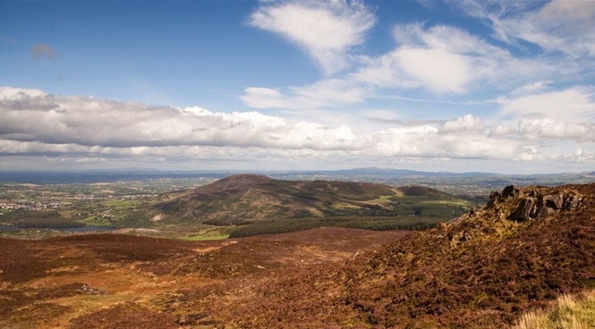
Slieve Gullion (from Irish: Sliabh gCuillinn) is a mountain in the south of County Armagh, Northern Ireland. The mountain is the heart of the Ring of Gullion, with an elevation of 573 metres (1,880 ft). At the summit is a small lake and two ancient burial cairns, one of which is the highest surviving passage graves in Ireland.

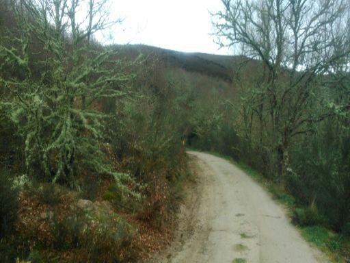
The walk starts and finishes in the car park adjacent to the Slieve Gullion Courtyard Centre in Slieve Gullion Forest Park. Follow the path uphill from the car park, passing the children’s play area on your left. The path continues uphill through deciduous woodland for about 1km until arriving at a log bench opposite a Ring of Gullion Way marker post. Turn right onto the forest drive and continue uphill through a stand of mature beech trees for 800m. Turn right onto a short section of forest track until the upper forest drive is reached. Turn left on the forest drive and continue along the southern slopes of Slieve Gullion for about 2km until an upper car parking area is reached on the left-hand side.

Turn right fifty metres beyond the parking area up an initially steep mountain path. Continue on over a stile until a stone shelter is reached. The views in this section expand to include the peaks of Slievenacapple and the Ring of Gullion to the North.

Passing to the right of the stone shelter the path becomes steeper, traversing areas of peaty and rocky ground. After 500 metres the path arrives at the summit of Slieve Gullion and the 5000-year-old Neolithic South Cairn Passage Grave, also known as the home of the Calliagh Berra.

Slieve Gullion 4

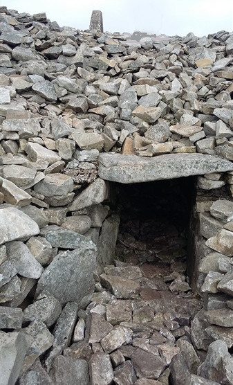
The tomb can be entered from just below the summit. Panoramic views from the summit take in the Mourne Mountains, Carlingford Lough, The Cooley Peninsula, the Armagh Drumlins and beyond.

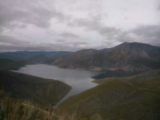
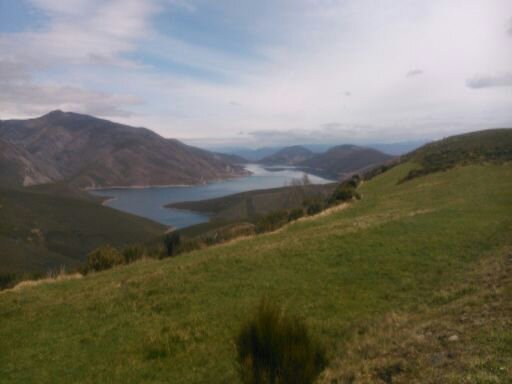
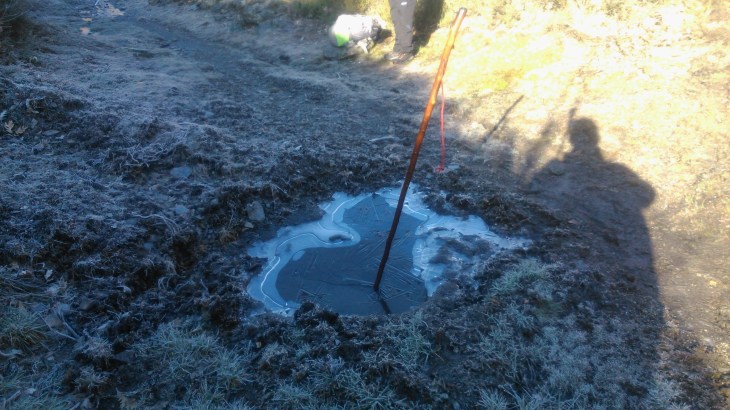
The path continues North-West along the summit plateau arriving at Calliagh Berras Lough after 800m.

Slieve Gullion 6

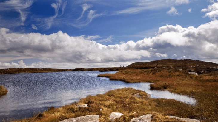
I met a local man who had explored the lough in an old-fashioned diving suit.  When he reached the end of his air hose, there was still a long way to go.  Nowadays, the lough is not only officially known as bottomless but, is also linked to the legendary hero Fionn mac Cumhaill. According to one tale, Áine and her sister Milucra both sought after Fionn . When Áine said she would never marry a man with grey hair, Milucra secretly put a spell on the lough, so that anyone who swam in it would emerge as an old person. She enticed him into the water, we are not sure how she did it but, in he went.  He emerged as an old man with grey-white hair. His men, the Fianna, forced her to give him a restorative potion from her cornucopia, but his hair did not return to its true colour.In some versions of the tale, Milucra is revealed to be the Cailleach Bhéirre, an ancient goddess.

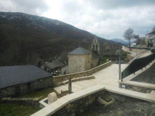
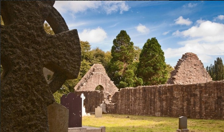
Continue past the lough to the North Cairn which is also a Bronze Age burial chamber.  Veer right after passing the North Cairn and continue on the path. Descend for about 2km down the North side of the mountain until reaching the Ballard Road. Turn right along the country lane and follow it as it undulates through the countryside. Keep right after 2km where the road forks and continue to Killevy Old Churches an ancient convent dating from the 5th Century. St Moninna is buried in the churchyard.

Slieve Gulluon 1

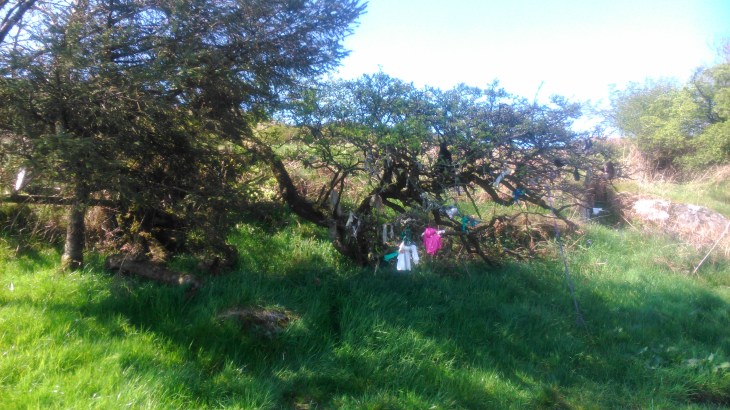
St Bline’s Holy Well is on the hillside above. There is a rag tree beside the well where you can hang your problems, in the form of a small piece of cloth and leave them behind.  These sites were not only known to early man but the tree, a fairy thorn,    also gives access to the underworld and the Tuatha Dé Danann.

Slieve Gullion 7

Continue along the country lane, past Clonlum South Cairn Portal Tomb on the left and Killevy Castle on the right for a further 2km before turning right at a crossroads. Continue through gateposts on to the exit drive from the courtyard centre and the car park.


Camino de Santiago-Via de Plata (Xunqueira-Ourense-Santiago de Compostela)

Ourense

The walk from Xunqueira to Ourense was well signposted but through an urban landscape and industrial estates.  Ourense is a beautiful and ancient city, with many fine buildings and a working Roman baths.  It certainly deserves more than our overnight inspection.  We left in driving rain, which followed us the whole way to Santiago.

In Santiago, I stayed in the Seminario Mayor.  At 23€ per night including breakfast, it was my most expensive lodging so far.  However, it is situated a few metres from the cathedral, and with the constant wet weather, well worth it, for the convenience.

Santiago 9

Santiago is a wonderful city, but it is clear that the huge baroque churches are now museums or tourist attractions, rather than places of worship.  They certainly meant nothing to me, compared to my experiences on the Meseta, welcoming the sun in the morning and living in the moment.

Walking the Via de Plata, on the old Roman road, some 1000 kilometres, almost the length of Spain, has been a lifetime experience for me.  It is difficult and should not be undertaken lightly, however, it is well worth every step.

Camino de Santiago-Via de Plata (Laza to Xunqueira de Ambia 34 kilometres)

Xunqueira

Xunqueira 1

Before leaving Laza we explored the dark and mysterious romanesque  church and cloister. It was dripping with ancient tombs.

Xunqueira 2

It was another beautiful walk, well signposted, along minor roads, through scenery, heavy and green, with a constant threat of rain in the background, it was Galicia.

Xunqueira 4

Xunqueira 5

We passed through tiny villages full of huge stone houses, most of them empty and collapsing back into nature.  Little ladies flitted around, too shy to speak to us, but we got the occasional, Buen Camino!  Xosé, Alberto, and the horses caught us up, walked alongside and then dropped back, in turn, all the while chatting in Galician.  In Xunqueira, there was a purpose built hostel, and  bars and shops in the village.

Xun

Camino de Santiago-Via de Plata (A Gudina-Campobecerros-Laza 34 Kilometres)

Laza

Sonia and I left Gudina at daylight, but full of breakfast, the bar opened early.  Xosé and Alberto were still getting the horses ready for the day and would catch us up later.  I found a young bird on the road.  I hid  it in the long grass and hoped it lived to sing another day.

Laza 2

Laza 3

Laza 4

The walk to Campobecerros was on minor roads with little traffic, through spectacular scenery, very steep mountains sweeping down to  enormous bluish green lakes on every side.

Laza 5.jpg

Campobecerros is an ancient but thriving village, with bars, a hostel and, surprisingly enough, plenty of young people and children.  However, on our way to Laza we passed through many deserted villages, in ruins, or just clinging on, with a few old ladies, very happy to talk about the Camino and to pass the time of day.

Laza 7

Laza is a busy little village.  The Xunta hostel is excellent, with all facilities.  You book in at the Protección Civil. There are two bars, which do good food.  The horses spent the night in a field just beside the hostel.  They were able to see Xosé and Alberto through the window and vice versa.  The night was filled with interesting horse conversation.

Camino de Santiago-Via de Plata (Lubián to A Gudina 25 Kilometres) — dandowlingblog

Today, we crossed the frontier into Galicia. When we left Lubián, it was well below zero, and we had a beautiful, but difficult, hike to the frontier, at 1260 metres. However, the sun came up and we had an excellent walk but mostly on roads, it had rained overnight and the Camino was impassable. We […]

via Camino de Santiago-Via de Plata (Lubián to A Gudina 25 Kilometres) — dandowlingblog

Camino de Santiago-Via de Plata (Lubián to A Gudina 25 Kilometres)

Galicia 5

Today, we crossed the frontier into Galicia.  When we left Lubián, it was well below zero, and we had a beautiful, but difficult, hike to the frontier, at 1260 metres.  However, the sun came up and we had an excellent walk but mostly on roads, it had rained overnight and the Camino was impassable.

Galicia 4

We stopped at one village which had only 30 inhabitants but had a very well stocked, shop, bar, and restaurant combined.

Galicia 2

Galacia 7


We reached Gudina to discover that the municipal hostel was closed for disinfection- bed bugs ( chinches), the curse of the pilgrim!

Camino de Santiago-Via de Plata (Puebla de Sanabria- Lubián 30 Kilometres)

Xosé, Alberto and Sonia (2)

I left Puebla with Sonia, Jorge and Nani and the two on horseback, Xosé and Alberto, were not far behind. Sonia, is a Basque girl, very lively and very kind.  She entertained me by playing rock music on her phone, in between texting her boyfriend. I could feel that what passed for the real world was crashing in all around me.

Lubián 2

Those heady days on the  Meseta seemed very far away, but such is the Camino.  Jorge and Nani are from Murcia, and were on a short walking holiday.  Xosé and Alberto and the horses were on their own cultural adventure to preserve Galician culture.  They spoke Galician and were delighted to hear that I spoke Irish.

Lunian 2

This was a hard walk on roads, at first, but then through beautiful, remote countryside, where wolves still roam free, to Lubián.

Lubián

Camino de Santiago-Via de Plata (San Salvador de Palazuelo-Puebla de Sanabria 21 Kilometres)

Puebla 4

Puebla de Sanabria is a beautiful and ancient town.  The walk was well marked and trouble free and when I reached Puebla, I had no problem finding the private hostel, Albergue Casa Luz, which is excellent and has all facilities.  However, I was now getting nearer to Santiago, and I noticed that several people were already booked in, including two travelling on horseback. My days of living in the moment and walking alone or with Victor across the huge expanse of the Meseta were over.  The world and what passes for reality were crowding in again.

Puebla 5


puebla 6

Camino de Santiago – Via de Plata (Olleros de Tera – Mombuey – San Salavador 33 Kilometres)

to Puebla

This is a beautiful walk through many ancient villages. When I reached Mombuey, I had a meal in the bar and stocked up at the local shops.  There are no other bars or shops for the next 27 kilometres.  There is a municipal hostel in Mombuey but it looked in very poor condition.

to Puebla 1

I walked on to the next village,  Cernadilla. I found three old people sitting in the evening sun, on a deserted main street.  They told me that there were very few people left, that the church and the hostel were closed and that I must walk on to the next village,  San Salvador de Palazuelo.

San Salvador is a  more substantial,  with a small hostel at the bottom of the hill, near the church.


Camino de Santiago – Via de Plata (Villanueva de las Peras – Olleros de Tera 18 Kilometres)

DSC_0082.jpg

I passed through several small villages on my way to Olleros – Santa Croya de Tera, Santa Marta de Tera, and Calzadilla de Tera. They were all very quiet.  They were clearly becoming depopulated, young people move away  for economic reasons, and houses and facilities fall into decay. This is very much the picture all over this part of Spain.

DSC_0085.jpg

However,  I was given a very warm welcome by the lady in Olleros, in Bar La Troucha. The alberge is basic, but she cooked an excellent meal and breakfast,  all for 12€.