Unknown's avatar

Posts by dandowlingblog

Dan Dowling is an artist who works both in oils and watercolour. He tries to live his art and draws his inspiration from his own life experience, his native north Belfast, walking and the philosophy of walking, Irish and Spanish language and culture, blogging and social media.

Newry Canal Greenway and Fathom Mountain Circuit

Newry1

This is a lovely 14 kilometres walk along part of what will eventually be a splendid continuous cross border greenway path running from Newry through Omeath to Carlingford.  This walk is circular and easy but maybe made moderate by a steady climb up Fathom Mountain.  For a map and statistics go to https://www.wikiloc.com/hiking-trails/newry-canal-greenway-and-fathom-mountain-circuit-33476172

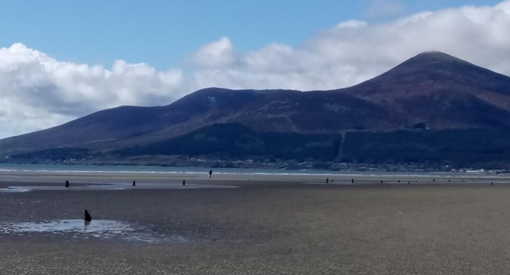
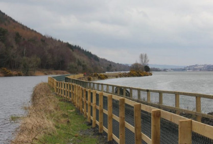
Start the walk in the centre of Newry at the Dublin Road Bridge.  There is a convenient nearby carpark.  The greenway is well signposted, it is a little industrial at the start by soon opens unto a wonderful vista between Carlingford Lough and Newry Canal.

Newry4

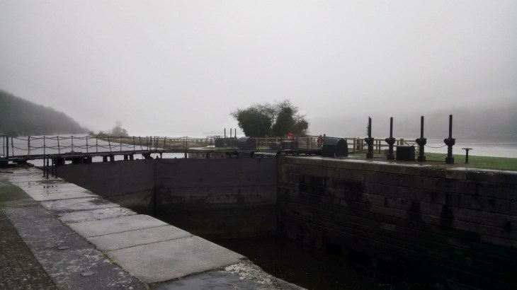
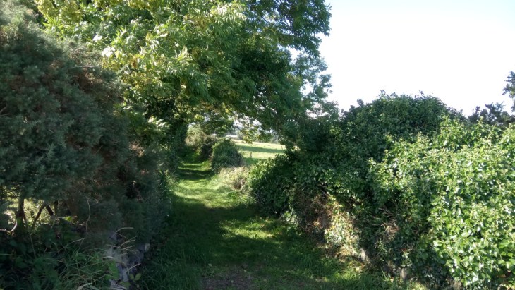
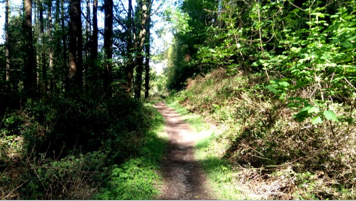
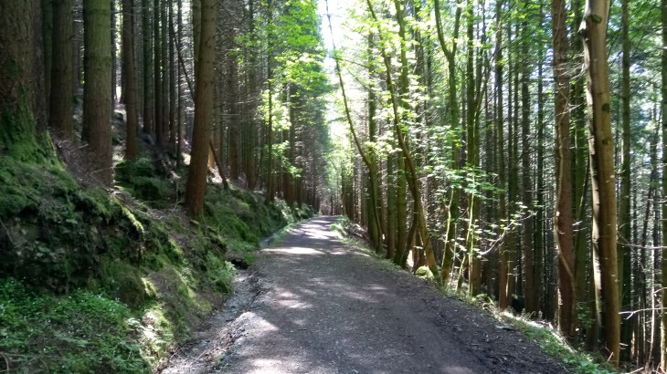
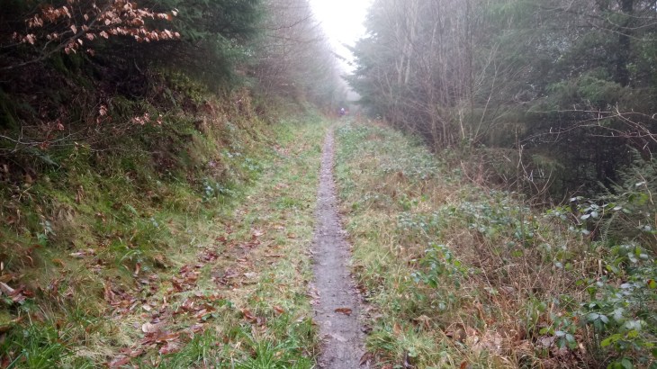
When you reach Victoria Dock, cross the busy road with care and follow the signs for Fathom View.  This is the start of the long steady climb up Fathom Mountain but it is a pleasant contrast to the canal.  Pass a substantial white house and continue to zigzag up the mountain.  Where the path levels out take a sharp right back towards Newry along a pleasant grassy track.

Newry3

This track will bring you to a minor tarmac road, the Flagstaff Road.  Turn right towards Newry and follow this road until you see a road closed sign on the right.

Newry2

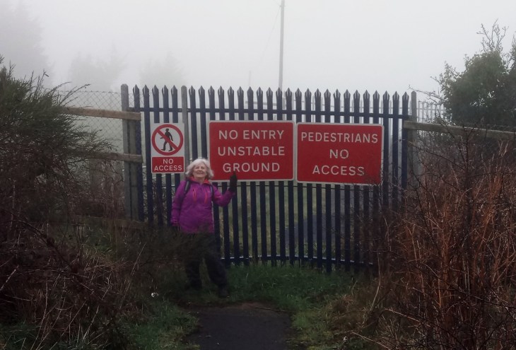
This is Hillhead Road.  It was closed about ten years ago due to subsidence as a result of over-enthusiastic quarry activity.  However, the local people assure me that they regularly walk around the barriers and there is a well-used track to prove it.  Follow the Hillhead Road down to the Drumalane Road.  Go left here and cut through the housing estate to reach Albert Basin, the canal and the carpark once again.

Khock Dhu Circuit

K3

Knock Dhu

This is an easy 14 kilometres walk going out over open heathland on a rough grassy track and returning on a quiet tarmac road in order to make it a circular route.  It is very well marked with white-topped posts and many reminders of Ireland’s ancient past including chambered graves, inscribed stones, flint mines and standing stones.  This one of the first areas to be inhabited after the last ice age, some 9000 years ago.  Knock Dhu itself is a bronze age (2000 B.C.) promontory fort recently excavated by the BBC television’s Time Team ( https://www.youtube.com/watch?v=1lmW3BUWpIM ), a fascinating watch revealing that a whole community lived here back in the day.  For a map and statistics go to https://www.wikiloc.com/hiking-trails/knock-dhu-circuit-33234212#list-wp-card

K1

Park in the small carpark above Cairncastle, Ballygalley, Larne,  in the shadow of Knock Dhu, grid reference 333072  on Ordinance Survey Discoverer Series, Sheet 9.  Directly across the road from the entrance to the carpark is a stile which gives access to the grassy track of the Ulster Way.

K4

Follow the white-topped posts not only to avoid the boggy bits but also to find a series of stiles which cross the difficult but magnificent dry stone walls. It is not recommended to attempt the walk unless you can clearly see the markers. Follow the route to Ballycoos, Scawt Hill, Ballygilbert and the trig point at Black Hill.  In this last section look out for a very knobbly standing stone,  great views of Slemish of Saint Patrick fame and the Scottish coastline.

K2

You will see from the map that, on our walk, we made a sharp left at this point, descending to the minor road.  This was due to a sudden and hellish downpour, not uncommon in this exposed area.  However, weather permitting continue to follow the posts to meet a minor tarmac road.  A right will take you to Glenarm and left is the return route to the carpark through Feystown.  This is a beautiful little road with very little traffic.  It is worth bringing a copy of the ordinance survey map just to identify the chambered graves and inscribed stone to be found in the fields on the left.  Keep left at the crossroads and drop back down to the carpark.

Gran Canaria-An Island with Two Tales


maspalomas 2

The Dunes at Maspalomas

My friend Gary and I recently spent ten days in Gran Canaria.  We stayed in Playa de Ingles, on the south coast of the island. Playa de Ingles is at the centre of six-kilometres of mass tourism stretching from Puerto de Morgán in the west to San Agustín and further in the east.  Many people spend a very pleasant week or three here, leading a hedonistic lifestyle and following the tourist’s eternal triangle; bar, beach and bed.

This is a very beautiful area and the local people are extremely friendly.  The climate is one of the best in the world, with temperatures between 18 and 25 degrees centigrade all year around.  The beaches are stunning and no more so than around the dunes at Maspalomas.  It does have an illusory quality and in fact, it is a purpose built tourist mecca dating back to the 1960s, built on what was virtually a barren though a gorgeous desert.  However, an hours drive away into the mountains brings you to another world.

fataga1

We took the road for the Barranco de Fataga, the biggest gorge in Gran Canaria which offers great walking opportunities.  Further on, the village of Fataga gives a real taste of Canarian life and food.

food

Climbing even higher it is hard to believe that the small town of San Bartolomé de Tirajana is the municipal capital of the south coast.  However, if you consider that the resorts of Maspalomas and Playa de Ingles were literally invented in the 1960s, it makes more sense.  People here make their living from farming, the almond being particularly important.  Another taste of real Canarian life.

san b

San Bartolomé stands on the site of a former Guanche settlement called Tunte, a name used by local people to this day.

Guanches were the aboriginal inhabitants of the Canary Islands.  It has been recently confirmed that they are closely related to the Berbers of North Africa.  It is believed that they migrated to the archipelago around 1000 BC or perhaps earlier.

After the Spanish conquest of the Canaries, they were ethnically cleansed by Spanish soldiers after a long and bloody struggle.  Many famous battle sites are recorded and monuments erected to courageous Guanche warriors.   Elements of their culture survive to this day, intermixed within Canarian customs and traditions such as Silbo (the whistled language of La Gomera Island).

roque1

At 4,606 feet we reached Roque Bentayga a sacred site and refuge of the Guanches.  Excavations have uncovered several groups of cave dwellings, together with granaries, cattle pens and burial sites.  Some of the caves are painted with fertility symbols and this is where examples of ancient inscriptions can be found, not deciphered to this day.

ag

We left the land of the Guanches and drove southeast to reach the mountain village of Aguimes.  Aguimes was founded in 1486, shortly after the conquest of the island.  It has wonderful small streets and several bars serving good Catalan food.

This has been a very brief tour of Gran Canaria, not even touching on the capital Las Palmas.  The fleshpots of Maspalomas may be a great place to relax and party till dawn but there is so much more to this island, it is a land steeped in history and culture.


Time and Reality

The Measurement of Time

The Measurement of Time Oil on Canvas 48X36ins

Here are two new paintings concerned with the intangible nature of time and reality.  Time is a very slippery customer.  If you try to get your hands on time, it trickles through your fingers like sand running through an hourglass. Everyone is sure that time is there but they just can’t get hold of it.  Maybe they can’t get hold of it because it isn’t there at all.  But if it isn’t there at all, why does it play such a fundamental role in every moment of our existence?

My first painting shows an hourglass, a traditional and ancient measure of time. The upper globe shows the busy Antrim Road, Belfast, at Atlantic Avenue.  It captures a moment in everyday life, a moment in time.  The sands of time drain into the lower globe but into a very different world. The timeless Great Pyramids of Giza and another traditional measure of time dominate the background while a man and a dog stroll past in the foreground.  This collection of disparate paraphernalia is simply food for thought. It is for the viewer to come to his or her own conclusion.

The Enigma of Reality

The Enigma of Reality Oil on Canvas 48X36ins

The second painting again draws its imagery from the Antrim Road, close to where I live and work.  It is concerned with the nature of reality.  Reality seems to be very fundamental and dependable.  Something, with whatever amount of poking and prodding, remains reassuringly solid.  However, think about our modern-day lust for simulated reality and our many journies in cyberspace.  Could we be a brain in a bell jar? Again food for thought.  Both paintings will be exhibited at the Royal Ulster Academy Exhibition at the Ulster Museum, Stranmillis, Belfast from 19th October 2018.


Slieve Commedagh and Donard from Newcastle

Commedagh1

This is a wonderful walk.  I would rate it as difficult as it includes two of the highest peaks in the Mournes.  However, the views of the Kingdom of Mourne make up for all that hard work.  For a map and statistics  go to www.wikiloc.com/running-trails/commedagh-donard-circuit-27975006

Start the walk in Donard car park on the southern side of Newcastle.  Leave the car park through the distinctive archway and turn left on to the Bryansford Road.  Follow the road to reach Tipperary Wood on the left at a road bridge over the Shimna River.  This is a lovely riverside walk which leads to Tipperary Lane, past Tipperary House and up to a narrow tarmac road.  Turn right on the tarmac road and then veer left on to an even narrower road which will take you steeply uphill. Go through a gate at the end of the road and cross a step stile beside another gate.  A forest track zigzags uphill and you turn sharp left at the first intersection and left again to reach the Drinns.

Donard2

At the Drinns you will see a small gate which will give you access to the rugged slopes.  There is a rough track from the gate but head roughly southwards towards a gap between a rounded hill close to the forest and the much larger Slievenabrock.  You will reach a ruined dry stone wall, step through a gap and start climbing steeply to reach the cairn on top of Shan Slieve.  Now follow a series of white posts to reach Slieve Commedagh at 767 metres.  Slieve Commedagh (from Irish Sliabh Coimhéideach, meaning the guarding, watching mountain) has a beautifully rounded summit with a prominent lookout tower dated 1913, built into the Mourne Wall.  From here there are wonderful views, in every direction, of the Kingdom of Mourne.

Donard1

Follow the Mourne Wall down a grassy slope to start the ascent of Slieve Donard, (from Irish: Sliabh Dónairt, meaning “Dónairt’s mountain”). The ascent is steep with some small well-embedded boulders in place.

Donard6

It is not possible to see the summit until you are almost there.  At the top, there is another tower dated 1910 and, of course, at 850 metres, wonderful views.

To return to Donard car park, retrace your steps back down Donard.  Then turn right at the bottom to reach a large cairn and then a rugged stone staircase to reach the Glen River.  Follow the river past the eighteenth-century ice house and eventually back to the car park.

Donard5


A week in London-Trinity Buoy Wharf


TBW3

The O2 Arena ( former Millennium Dome) from Trinity Buoy Wharf

My friend Gary and I recently spent a week in London.  We went in search of the lesser known sights of the capital, the interesting and the obscure, well away from the relentless tramp of the tourist. Trinity Buoy Wharf certainly fell into this category.

Trinity Buoy Wharf is the Thameside site where all the buoys and markers for the River Thames were once made and repaired. The site was rescued from dereliction and now its lighthouse (the only one in the capital) overlooks a growing creative community.

TBW6

The Lighthouse

Preserving the Grade II-listed warehouses, the developers have constructed artists’ studios, offices and a riverside café from recycled shipping containers and forged relationships with London’s art colleges, whose students are delighted to have access to the site’s large spaces for ambitious projects. ENO make all their props there, the Roal Drawing School have their Foundation Year Art School there and there are a host of other creative tenants. The fleet of Thames Clippers is based there – at one of London’s longest piers, which was built almost entirely from recycled materials.

Also located on the site are a nostalgic ’40s food joint, FatBoy’s Diner, and what may be London’s smallest museum, The Faraday Project. Housed in a tiny wooden hut, it’s devoted to the Victorian scientist Michael Faraday who conducted experiments into electric lighting in the lighthouse in 1863.

TBW1

Artist’s Studios and Offices

TBW4

The Faraday Project

Today the lighthouse is an unusual art venue (open to the public at weekends, 11am-5pm in summer, 11am-4pm in winter), hosting Jem Finer’s ‘Longplayer’, a digital musical composition, commisioned by Artangel and designed to play in real-time, without repetition, for a millennium.  An installation by Ingrid Hu of 234 singing bowls is part of a 667ft wide instrument used on occasion to perform a section of ‘Longplayer’ live.

The most exciting way to get to Trinity Buoy Wharf is by taking a short ferry trip across the Thames from the O2 QEII Pier (Mon-Fri 5am-7pm; £2 each way).   This little boat holds about six people and seems strangely incongruous in the beating heart of an ultra-modern metropolis.   Rather than returning on the ferry you can make a really interesting round trip.  It is a short walk to Canning Town Station from where a couple of stops will take you to the Emirates Airline cable car.  For £3.50 you can fly back to the O2 Arena and enjoy not

Emirates1

Fly Emirates

only wonderful views of this vibrant part of the city but also a very well informed commentary.

The Castlewellan Loanans

Castlewellan7

This is an easy, 11 miles, circular walk on quiet roads and grassy tracks.   A number of old laneways and field paths around Castlewellan have been cleared, improved and signposted by Down District Council as public footpaths and bridleways.  They form a network that connects with main roads and minor roads, offering walks where you can leave the tarmac and cut across country away from the traffic.  There are two loops which can be linked together to give an excellent day’s walk; one around Maghera, and the other around Burrenreagh and Burrenbridge.  For a map and statistics go to https://www.wikiloc.com/hiking-trails/castlewellan-loanans-28470669 The map, in this case, shows the walk ending in Castlewellan but the description will cover the return leg to Maghera.

Maghera Inn

We started and ended the walk at the Maghera Inn on the Ballyloughlin Road between Dundrum and Newcastle OSNI Discovery Sheet 29.  From the car park turn left and follow the Carnacavill Road, past the Mourne Archery Centre and shortly turn left again on Carrigs Road to find Maghera Old Church and Round Tower.

Castlewellan 2

A green gateway on the left gives access to a Church of Ireland building but the ruins of a much earlier church lie behind together with an ancient circular graveyard and the stump of a round tower in a field nearby.  These are the remains of a monastery associated with Saint Domangard, a fifth-century follower of Saint Patrick, from whom Slieve Donard derives its name.

Castlewellan 3

From here retrace your steps to the Carnacaville Road and turn left past Saint Joseph’s Primary School to shortly find a grassy bridleway on the left.  This very pretty lane, Smiley’s Lane, will bring you to Church Hill.  Turn right to find the main Castlewellan Road, cross the main road with care and follow Tollymore Road to Wild Forest Lane.  Follow the lane to reach a white house on the left dated 1700, turn left here and follow another beautiful laneway to reach the Bryansford Road.  Cross this busy road, again with care to find one of the impressive gates of Tollymore Forest Park.

Castlewellan 4

Go straight down the magnificent, tree-lined driveway and turn right at the old stables.  There are toilets here and nearby are picnic tables, a great spot for a lunch break.  Leave Tollymore by the gates at the stables which open unto the Hilltown Road and the village of Bryansford.  Cross the  Hilltown Road and walk down the quiet Burrenreagh Road directly ahead.  After approximately a mile veer left unto the even quieter Burren Road to enjoy excellent views of the Mourne Mountains.

The Burren Road twists and turns past farms and houses to reach a well-marked public footpath on the right.  This is another grassy track which will bring you uphill to some old farm buildings, an empty house and a corrugated iron shed.  Go right here and downhill unto the Upper Burren Road.  Turn left to shortly find another public footpath on the right leading you steeply downhill to the Lower Burren Road.  Turn left and follow the Lower Burren Road to Cow Lane on the right.

Castlewellan6

There is no obvious path, simply cross the field to reach a small gated bridge, cross the bridge and veer right to find yet another small bridge, cross this to find a steep stile leading you to a grassy track, then a tarmac street which will bring you into Castlewellan.

Castlewellan is a beautiful old town and well worth a visit even for a cup of coffee.  It owes its street plan to William Annesley who bought the village in 1741 and redeveloped it.  The courthouse, now the library dates back to 1764.  From the Courthouse walk around Upper Square to find Circular Road.  Walk along Circular Road past the community centre.  After approximately a mile, the road narrows, Circular Road goes sharp right but keep straight on up Bunkers Hill. Just here at an old farmhouse you will notice a sign for a public footpath, ignore this and continue straight on for a couple of hundred yards to find another sign pointing you up to the left past the gable end of a grey house.  Turn right at the top and enjoy another beautiful old road with splendid views.  There is an intersection at a large white house, keep left here and then later go left an right past the occasional ruined building to reach the Carnacaville Road.  Turn left to reach the Maghera Inn again.


Walking the Sheeps Head

The Sheep’s Head Way, located in West Cork, Southern Ireland, is a peaceful, unspoilt peninsula which has some of the most beautiful scenery in all of Ireland.

Sheeps Head 1

To be found there is a 200km walking route located on the narrow Sheep’s Head peninsula,  between Bantry Bay and Dunmanus Bay.  The route also extends eastwards from Bantry to Drimoleague ( www.drimoleaguewalkway.com )  and Gougane Barra offering further walking opportunities in the region.

Sheeps Head 2

My friend Joe and I were off on tour again.  We were camping at Eagle Point, Ballylickey https://www.eaglepointcamping.com/ which is not only a spectacular campsite but also a great base for walking in and exploring West Cork.  On our first day, we walked the Sheep’s Head.

Sheeps Head 3

The narrowness of the peninsula means that you are never far from the glorious and wild Atlantic Ocean, even on the outward stretch when you climb to the route’s highest point, 300 metres above sea level, on the heathery Seefin ridge.  The terrain is varied and includes old boreens, open grassy and heathery hill, rock, field paths, quiet roads and some short stretches of woodland path.  This variety allows for all levels of hiking.  Joe and I wandered along an old road for miles. When I say old road, I mean the best type of old road with grass growing down the middle and little or no traffic.  The scenery was incredible.

Walking the Sheep's Head

The village of Kilcrohane (rush hour)

We finished the walk in the village of Kilcrohane, were the friendliness of the locals is only outshone by the quality of the Guinness.

Slieve Martin and the Cloch Mór

This is a moderate, seven-mile circular walk through woodland and open countryside on rough tracks and paths.  For a map, statistics and more photographs go to https://www.wikiloc.com/hiking-trails/slieve-martin-and-the-cloch-mor-24675668

Start at the carpark in Kilbroney Park, just along the coast road from Rostrevor.  From the carpark go right, back downhill the way you came in to find a redbrick building.  Here, turn left, cross a  carpark and follow the signs uphill for Fiddlers Green. http://fiddlersgreenfestival.eu/

Martin1

Fiddlers’ Green

At Fiddlers’ Green, the main path vers right. Follow this and you will notice another going sharp left.  Walk past this to shortly find an ancient tree with a sign pinned to it ” The Big Stone”.

Martin4

Leprechaun sign to “The Big Stone”

Follow the very minor track, zigzagging uphill.  This is a tough but delightful part of the walk.

Martin3

Follow the track to the end to reach the open ground and then go straight ahead to find the Cloch Mór, a glacial erratic. https://en.wikipedia.org/wiki/Cloughmore

Martin5

The Cloch Mór

After the Cloch Mór, take the path leading uphill to the highest point of the walk, marked by an aerial.

Martin6

Drop down the hill on the far side to a wood enclosed by a wall.  Lookout for a break in the wall, a stile and a stream.

Martin7

Cross the stile and follow the track through the forest.  This will lead you to a clear gravel path which will bring you back full circle to the car park.

Martin8


Dundrum and Murlough Nature Reserve

This is a beautiful, easy, seven miles, circular walk on the beach and then returning on trackways through the sand dunes. For a map and statistics go to https://www.wikiloc.com/hiking-trails/dundrum-bay-and-murlough-nature-reserve-24285225

Murlough5

We started the walk in the village of Dundrum.  We parked on Main Street and took the minor road on the left signposted Keel Point. At the bridge, we went left and dropped down unto the beach.

Murlough2

We followed the beach around the headland keeping Ballykinler Army Base on the left.  When the red flag is flying there is the sound of gunfire from the range.  But it is not disturbing and certainly, the large pod of seals seem to be oblivious to it and bask happily on a sandbank nearby.

Murlough3

Having rounded the headland we continued to followed the beach towards Newcastle and the Mountains of Mourne.  Before reaching Newcastle, we stopped for a picnic lunch and then turned at one of the many entrances into Murlough Nature Reserve.  The reserve is a very well maintained area of sand dunes.  There is a series of tracks which are all well marked with signs which give additional information on local flora and fauna. We completed the loop on the main track back to Dundrum village.