This is an easy, to moderate, 15.8 kilometers, circular walk on quiet tarmac roads and lovely old grassy tracks. It will not only take you on a ramble through both ancient and contemporary Irish history but also give you excellent views of the Mountains of Mourne. For more information, a map and statistics go to http://www.wikiloc.com/wikiloc/view.do?id=15111961
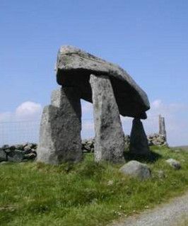
To reach the dolmen, drive straight through the village of Dromara and then the next village Finnis. Shortly after Finnis, you will pick up signs for Legananny Dolmen and Souterrain. There is a small car park beside the Dolmen. It is a very elegant structure and well furnished with information signs. The exact purpose behind its construction has been lost the mists of time. However, it is thought that the people who built it realized that countless generations had passed before them without leaving a trace of their existence. They, not only wanted to make their mark in time but also to time travel into the future and say to future generations, we were here and we were clever and sophisticated people.
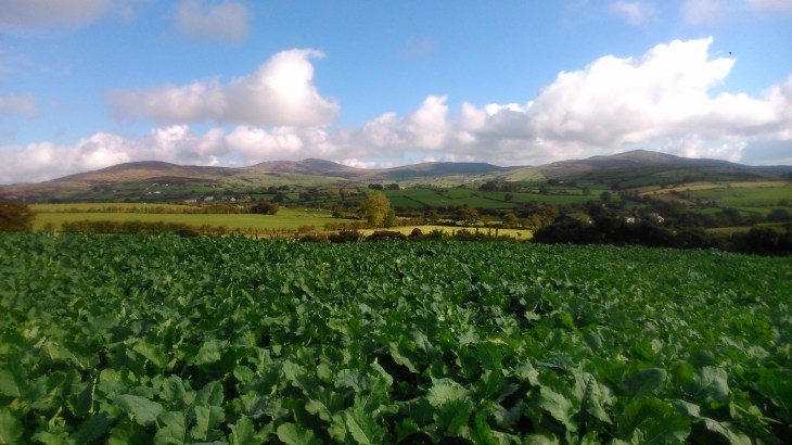
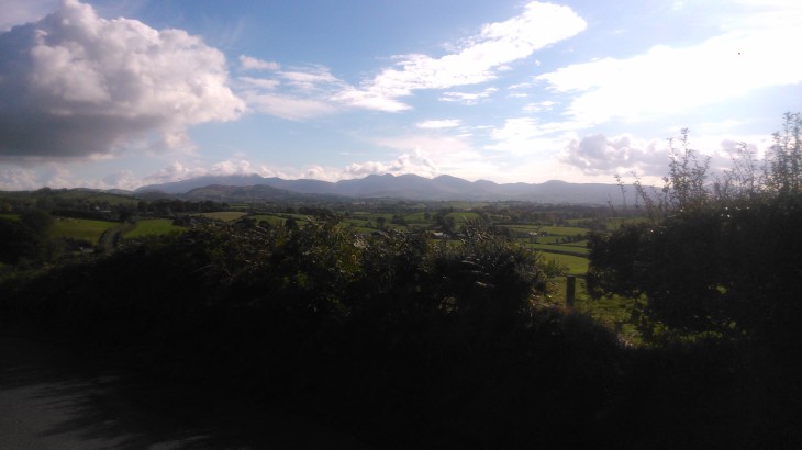
From the Dolmen, walk back the way you drove in and at the top of the hill, you will see a wooden sign marked Footpath. Take this, keeping right at the fork, and it will lead you to the Slievenaboley Road. Turn left to the car park and viewpoint. Here you will get excellent views of the Mountains of Mourne, Slieve Croob, the Belfast Hills and,on a clear day, the Sperrins.
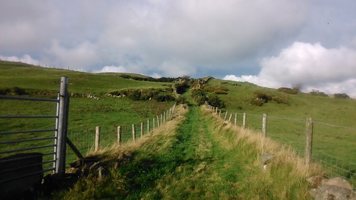
Follow the road downhill and then turn right along Lighthouse Road. At the top of the hill, take a right along a path marked Moat Pad Footpath. Follow the yellow arrows , keeping left. “Moat” refers to several ringforts or raths, to be found at the end of the track. Look out for a gate on the right and take the track at first going up a hill and then down through a farm-yard. The farmer is very friendly and always happy to stop for a chat. Red kites are frequently seen in this area. Were the farm track reaches the tarmac road, look in the fields directly in front and to the left and you will see two large raths or ringforts, encircled with trees.
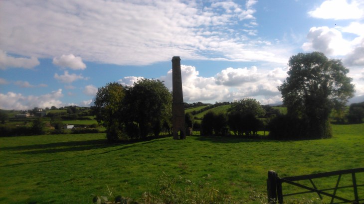
Go left on the tarmac road and this will quickly bring you into the village of Dechomet. There is some debate as to the origin of the name Dechomet but it is thought to come from the Irish Deas Coimhéad – good look-out post/good prospect. Walk straight through the village and you will come to something remarkable. In a field on the left, you will see a substantial red brick chimney, with a rath behind enclosing an ancient circular graveyard. The story goes that the chimney was the beginning of a linen factory. The gravestones were removed prior to preparing the ground for the factory. The linen industry collapsed almost overnight under the pressure from cheap imports and work stopped on the factory. No record had been kept of the original positions of the gravestones, so rather than replace them with the wrong owner, they were placed in a circle at the edge of the rath.
From here, return to the village where Turley’s Bar is worth a visit. Now, take the Ballymacilreiny Road. This road undulates through low farmland passing Derryneil Baptist Church. When you reach the T-junction with the Millvale Road, go left and within 100 meters, turn left again on Adder’s Loanin Footpath. Follow this beautiful old grassy track past some ruined cottages, through another farmyard and you will eventually come back full circle to Lighthouse Road. Retrace your steps going left along Lighthouse Road. At the T-junction go left and then sharply right, climbing up Legananny Hall Road. When you come to the Orange Hall go sharp left and this will bring you back to the dolmen and the car park.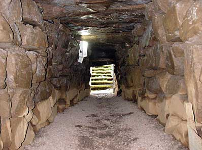
The souterrain is also worth a visit. It is well signposted with plenty of information. It dates from the 5th century and when you are in the passageway or one of the chambers, place your hand on any of the stones and there is a very good chance that the last person to touch that particular stone lived in the 5th century.

[…] Legananny Dolmen Circuit […]
LikeLike